

Archive Record
Images
Metadata
Description |
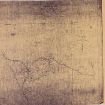
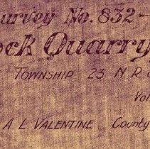
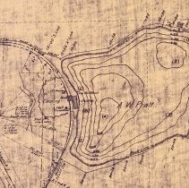
SR003a - This is a topographic map of the Swing Rock area (called Rock Quarry), made in 1908. SR003b - The notation on the survey map, Titled Rock Quarry Survey No. 832. SR003c - The 1908 survey map, cropped to the Swing Rock area. Using the topographic data, it was calculated by Scott Massey that the area of the Rock Quarry was about 12.2 acres, with the height at highest point 125 ft. |
Search Terms |
Towns/ Snoqualmie |
Catalog Number |
2019-006.SR003a-c |
Object Name |
Map |
Collection |
Fall City Historical Society |